California’s latest climate assessment shifts from forecasting risks to helping communities respond to impacts already underway.
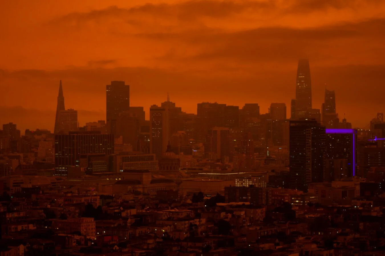
California’s Fifth Climate Change Assessment arrives with a harder job than describing what might happen: it has to help the state respond to changes already underway. That shift matters. Earlier warnings about shrinking snowpack, longer droughts, dry wells, extreme heat and abrupt swings from drought to flood have become familiar parts of life in California—and some have hit harder and more often than scientists expected.
The state has gathered climate research periodically since 2006, and current law requires an assessment at least every five years. These reports synthesize the best available science over several years, with scientists working alongside community members and Tribes and independent experts reviewing the work. The new assessment is the latest version of that effort. Here’s the test: can more detailed local projections and community input help people make decisions before the next disaster?
Before joining UCS, I coordinated the San Joaquin Valley regional report for the Fourth Assessment. It was the first climate assessment focused specifically on the Valley. We laid out risks that then seemed prospective. Since then, many have arrived.
Warnings that have become lived experience
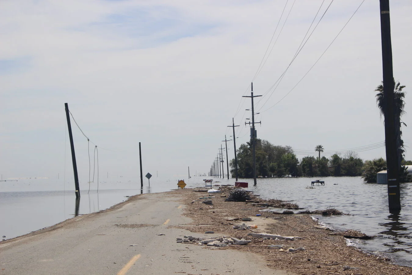
California’s 2020–2022 drought left thousands of domestic wells dry, mostly in disadvantaged communities. Then, during one winter, nine atmospheric rivers arrived in three weeks. Flooding brought Pa’ashi (Tulare Lake) back across a lakebed drained a century earlier, inundating roads, farms and homes. This year, California’s April 1 snowpack stood at just 18% of average. Climate change made the West’s snow drought about four times more likely. Our recent research finds that emissions from major fossil fuel polluters have a pronounced effect on the water cycle.
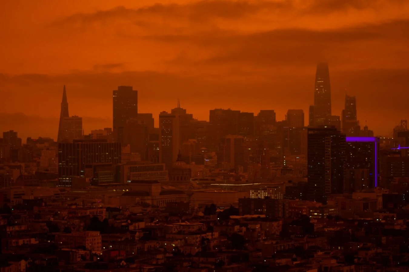
Fire records tell a similar story. Nine of California’s 10 largest wildfires have happened in the past decade. The Dixie and August Complex fires alone burned nearly two million acres. Altogether, roughly 14 million acres burned in California over that decade—about 14% of the state. UCS research attributes 37% of forest area burned in the western United States and southwestern Canada since 1986 to emissions traced to 88 major fossil fuel producers and cement manufacturers.
The 2025 Palisades and Eaton fires made the human and financial cost impossible to treat as an abstraction. They became the most expensive wildfire disaster on record, with estimated losses of up to $250 billion and more than 16,000 structures destroyed. Thirty-one people died directly; another roughly 440 deaths were indirect. Climate change made the fire weather 35% more likely and 6% more intense.
And this is not only a California story. Hurricane Helene killed more than 200 people in the United States in 2024, most of them in North Carolina. Climate change made its rainfall about 10% heavier and winds about 11% stronger. A 2023 heat wave killed a record 645 people in metro Phoenix. Researchers concluded that the month-long extreme heat would have been “virtually impossible” without climate change.
The 2021 Pacific Northwest heat dome killed hundreds in Oregon, Washington and British Columbia. Without human-caused climate change, an event of that severity would have been at least 150 times less likely. Add another 1.4°F of global warming, and heat domes that might now occur once in a thousand years could happen every five to ten years.
Elsewhere, climate change made Pakistan’s devastating 2022 monsoon rains up to 50% more intense, affecting more than 33 million people. It made the 2023 rains that caused two dams above Derna, Libya, to collapse up to 50 times more likely, killing thousands. And it made the rainfall behind more than 230 deaths in Valencia, Spain, in 2024 about 21% heavier.
By mid-2026, marine heatwaves covered about 82% of the global ocean, with consequences for ecosystems and fisheries that remain difficult to predict. The oceans have taken up about 90% of the excess heat trapped by climate change. That stored heat is already helping fuel stronger storms and marine heatwaves; it will also keep raising sea levels for centuries, even if emissions stopped now. The “ticking bomb” comparison is apt, though the damage is unfolding in the present as well as the future.
Knowing what is coming gives communities a chance to prepare. Losing the ability to measure those risks makes that harder. Many scientists are deeply concerned that the current US administration disbanded the author team for the sixth National Climate Assessment, the country’s main effort to assess climate risks across regions and sectors.
Stopping the measurements doesn’t stop the threat. It delays recognition, raises the eventual cost and leaves people with the fewest resources exposed first—sometimes fatally. In 2022, the White House Office of Management and Budget estimated that climate change could add up to $2 trillion a year to the federal budget by the end of the century. California’s assessment is meant to help prevent or reduce that kind of loss and destruction.
What’s changed in California’s Fifth Assessment
Four changes stand out. Together, they suggest the state is trying to make the research more useful to people deciding where to invest, what to protect and how to adapt.
- The reports look at warming levels as well as calendar years. They ask not only what California might face in 2050, but what happens when the world reaches 2°C of warming. That gives planners a way to match the intensity of impacts to the investments communities may need.
- Climate projections are more local. New downscaling methods translate global climate models into projections for California’s valleys, mountains, deserts and coasts.
- Communities and Tribes helped shape the research. Each regional report involved consultation. The San Joaquin Valley report in the Fourth Assessment showed the state that this process could make the work more connected to people’s lives, and it is now part of every regional report. Tribes also received more support to conduct their own research than they did in the previous assessment.
- The work is turning toward solutions. Scientists have a clearer picture of how California’s climate is changing and what those changes are likely to do. The assessment now gives more attention to responses that people on the ground want—and in some cases are already trying.
Seven numbers that describe California’s climate risks
The statewide summary gathers results from across the assessment. These figures show why the stakes reach well beyond environmental policy: they touch water supplies, public health, housing and household costs.
- Temperatures keep climbing. Average temperatures are projected to rise 3.5°F to 4.3°F (1.9°C to 2.4°C) by 2050 and 5.7°F to 8°F (3.2°C to 4.4°C) by 2100, depending on global heat-trapping emissions.
- The snowpack is shrinking. April snowpack, an essential water reserve, is projected to decline about 40% by mid-century and 60% by the end of the century.
- Wet and dry years will swing more sharply. One in five Californians—about 7 million people—already live in areas at risk of flooding.
- Wildfire smoke will cause more deaths. California is projected to see the largest increase of any state, with more than 5,000 additional deaths per year by 2050.
- Heat waves will stretch on. In a high-emissions scenario, the year’s longest heat wave could grow from about three days statewide today to 19 days in the Sierra Nevada and 17 days in the Inland Deserts by century’s end. People living unsheltered make up 0.5% of Californians but account for 13% of heat-related hospitalizations.
- Rising seas will expose people and property. Sea level rise of 0.8 feet (0.2 meters) by mid-century and 3.3 feet (1 meter) by 2100, combined with a 100-year storm, could put 166,000 people and $60 billion in property at risk of coastal flooding by mid-century. By 2100, the figures could reach 310,000 people and $122 billion.
- Californians are already paying. Average home insurance premiums rose 85% between 2020 and 2026. Wildfire costs account for about 5 of the 6.2 cents per kilowatt-hour increase in electricity prices from 2019 to 2024.
Across all nine regions, the burden is uneven. Farmworkers, Tribes, rural communities, renters, people living unsheltered and low-income families face greater exposure and have fewer resources to recover.
In the San Joaquin Valley, water connects the risks
I live in the San Joaquin Valley and coauthored its regional assessment again. It is one of North America’s most transformed landscapes, shaped by structural problems and deep injustices. UCS focuses on the region partly because there are practical opportunities to improve resilience, prosperity and well-being without requiring enormous costs.
The Valley is home to 4.4 million people, most of them in disadvantaged communities. Dozens of Tribes live here, having endured genocide and displacement over the past two centuries. The region is also the most profitable agricultural region in the United States. That prosperity has come with profound environmental change: the Valley has lost 95% of its original wetlands and riverside forests, driving a major loss of natural resilience to drought, floods and extreme heat.
Groundwater overdraft has also caused the land to sink. In some places, it has dropped by more than an inch per month during droughts, permanently reducing the underground storage needed for future water and food security, according to NASA research.
The regional report’s findings make clear how tightly the Valley’s climate and economy are linked:
- The Valley is heating quickly. Temperatures have risen nearly 3°F (1.7°C) in the past half-century and could rise as much as another 5.5°F (3°C) by 2100. That puts crops and livestock at risk, along with the farmworkers and outdoor workers who help feed the country.
- Fruit and nut trees are losing winter chill. Much of the Valley has lost 160 to 400 winter chill hours over four decades. Models project about 20% fewer hours by mid-century, threatening walnuts, pistachios and stone fruit such as cherries.
- Water conditions are growing less predictable. Snow melts earlier, droughts intensify and the atmosphere is becoming “thirstier”. The 2012–2014 drought was the most severe in at least 1,200 years, while extremely wet years are also becoming more likely.
- Groundwater is being spent faster than it is replenished. The Valley overdrafts its “water savings account” by about 2.2 million acre-feet each year. Thousands of wells have run dry, and nitrate, arsenic and uranium become more concentrated in communities least able to afford water treatment.
- Agriculture will have to change. Future climate projections suggest irrigated acreage could fall by as much as about 40%. The current system depends on water that isn’t available and a climate that no longer exists.
The communities facing these risks often face several at once. Rural residents breathe some of the country’s most polluted air, and are also more likely to lose wells, work in dangerous heat and wait longer for help. Valley fever, which can be lethal and is increasing amid swings between wet and dry conditions, hits the San Joaquin Valley and its farmworkers especially hard.
Valley solutions are already being tested
The Valley’s landscape will change. The question is who shapes that change. Research suggests that strategic cropland repurposing, especially in revitalization zones near communities and guided by residents, could conserve water, cut nitrate and pesticide pollution, restore habitat and create better-paying jobs. Those gains could help communities thrive as climate impacts intensify. Poorly planned conversions could instead produce dust bowls, ghost towns and fresh injustices.
The Fifth Assessment documents solutions already working in the San Joaquin Valley and elsewhere in California:
California’s strongest climate responses are the ones that solve more than one problem at a time. They can reduce flood and wildfire risk, improve water supplies, support local livelihoods, and give communities a say in how land is used. That combination matters more than any single intervention.Land and water projects with local benefits
In Allensworth, the [Allensworth Progressive Association](https://www.allensworthpa.org/) is developing a community-owned Agroecology Hub for regenerative agriculture, agrivoltaics, and land access for farmers of color. The [community plan](https://tc-web.widen.net/view/pdf/t7rv3hgbm7/Allensworth-Community-Plan---edited-ADA-Compliant.pdf?t.download=true&u=uycpe9&use=uqqtm) lays out that work; you can also [watch a short documentary about Allensworth](https://www.ucs.org/resources/town-chose-thrive). Fairmead offers a different model: residents are converting a 17.3-acre almond orchard into a stormwater basin with native habitat and a walking path. Projects like these create [buffers or revitalization zones](https://www.sciencedirect.com/science/article/pii/S0048969722070632) around communities. California’s [Multibenefit Land Repurposing Program](https://www.conservation.ca.gov/dlrp/grant-programs/Pages/Multibenefit-Land-Repurposing-Program.aspx) funds these transitions, which are already showing positive results. Water storage can also happen underground. Roughly 3.6 million acres of California farmland could be used to recharge aquifers with floodwater, saving some of that supply for the next drought. The qualification matters: recharge sites must be screened to avoid contamination. At Dos Rios State Park, Mewuk and Yokuts Tribal communities guided the transformation of a former dairy into California’s largest floodplain restoration. Reservoir managers can complement that work through forecast-informed reservoir operations, or [FIRO](https://blog.ucs.org/angel-fernandez/firo-to-avoid-fomo/), which can keep more water in storage without raising flood risk. Tribal stewardship has direct consequences for wildfire and river ecosystems. Prescribed and cultural fire can reduce the likelihood of catastrophic wildfire by up to 92% for a decade. And after decades of advocacy by the Yurok, Karuk, and Klamath Tribes, removing four Klamath River dams reopened more than 420 miles of salmon habitat. Energy and farming need the same attention to who benefits. Solar on repurposed farmland and [agrivoltaics](https://www.ucs.org/resources/agrivoltaics-and-ecovoltaics) can cut emissions and create jobs when communities support the projects. On farms, cover crops, compost, and diverse plantings help soil retain water and crops withstand heat and drought.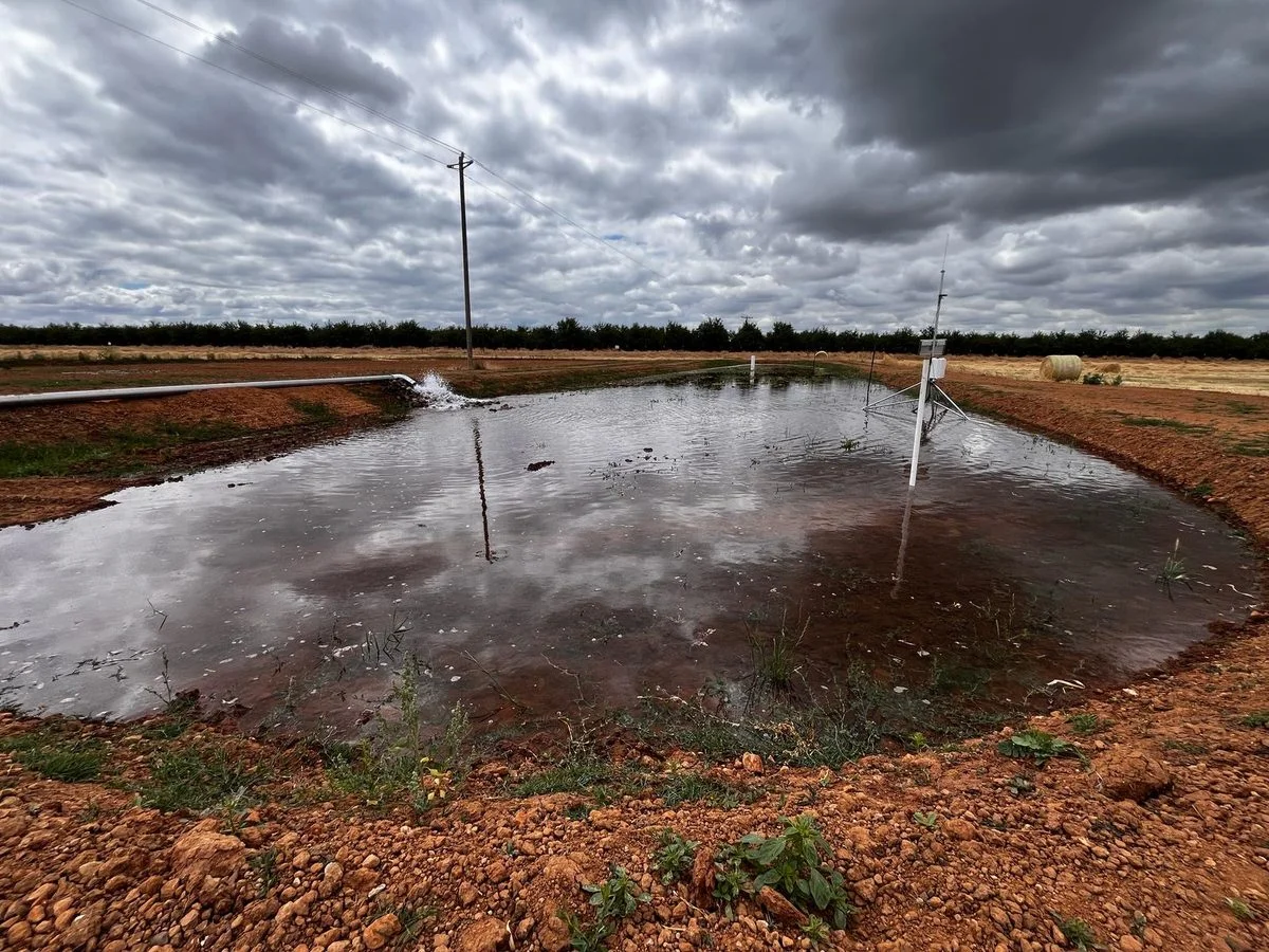

Discussion
Sign in to join the discussion.